If you ever wonder where I am, this is the place to check out. Now some of you guys already know that my means of transportation is largely by boat, so I must be somewhere in or close to the blue spots of the globe. But if that does not satisfy your curiosity, I have a few maps and options for you here.
No Foreign Land
Below you see a map pointing to my last known location. You can freely move and zoom around in the map and by clicking on the little boat icon, you’ll be redirected to my boats page on noforeignland.com where you can get all kind of additional information about my boat, crew and past journey. And whenever I move, you’ll see it here in real time using data from my AIS or Garmin InReach Mini via satellite.
VesselFinder
Another way to find me is my the map shown below from VesselFinder.com with a variety of different information including my current speed. Feel free to navigate around, go to VesselFinder directly and see what else is floating around me at a given time, the oceans are quite busy these days.
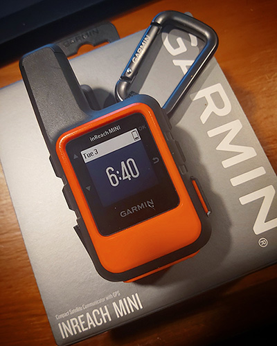
InReach Mini
This is my trusty Garmin InReach Mini, an affordable little satellite communicator with plenty of features. Text messaging, tracking, emergency “SOS” button, long battery life and able to receive marine weather data for a monthly subscription which I think is unbeaten as of Today.
When I am sailing, it is always charged, turned on and clipped to my life vests harness and actively tracking my route with a new data point every few hours.
Combined with my AIS (Automatic Identification System) aboard Serenity, you can rest assured that at least one of the two maps above is pretty much always fed with accurate and current positions.